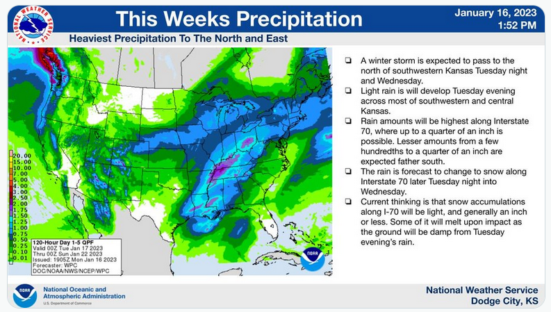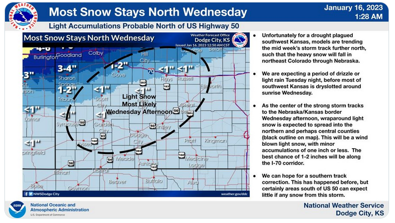
The National Weather Service has increased the chances of wintry weather returning to Hays and northwest Kansas this week — but is predicting western Kansas won't see much moisture from the system.
The NWS said models show the storm system tracking farther north, with the heaviest snow in northeast Colorado and Nebraska.
While there is a 70 percent chance of rain, freezing rain and snow before midnight Tuesday and throughout Wednesday, less than an inch of total accumulation is predicted for the Hays area.
Areas in extreme northwest Kansas could see snowfall totals in excess of 4 inches, the NWS said.
After a Monday high expected to hit the upper-50s, the temperature will drop quickly this week, with a high of 45 predicted Tuesday and a high of just 35 predicted Wednesday.