
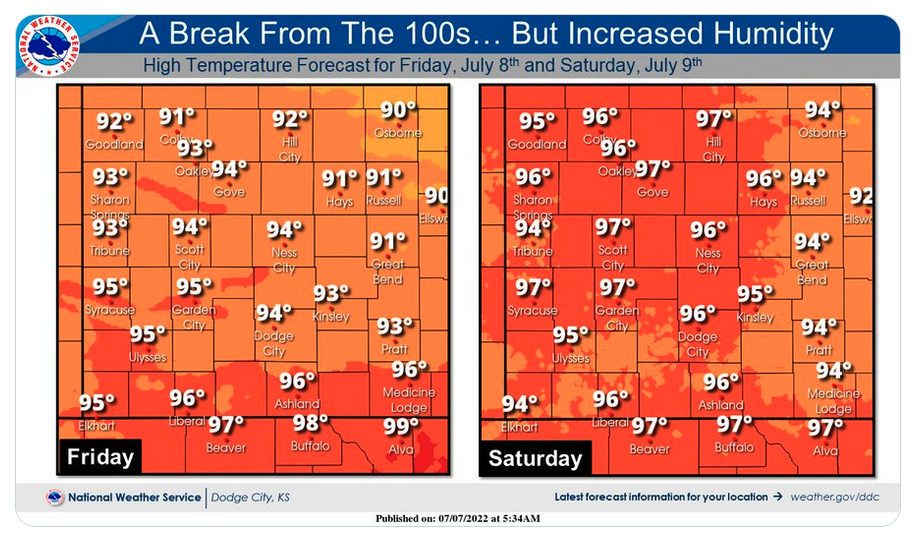
The Hays area will get a break from extreme temperature Thursday and Friday, with highs in the low-90s predicted each day.
The National Weather Service said a weak cold front will move across the area, dropping the mercury but hiking the humidity.
After receiving 0.8 inches of rainfall Wednesday afternoon, there is a slight chance of more showers and thunderstorms Thursday evening. There is a 10 percent chance of showers after 5 p.m., with a 20 percent chance between 8 and 9 p.m.
The reprieve from heat won't last long, with highs in the upper-90s to triple digits predicted Saturday through Monday.