
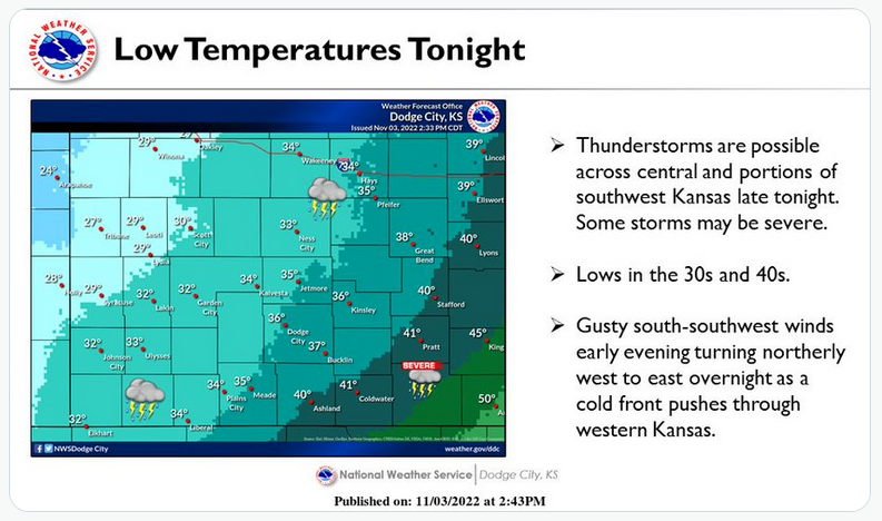
The National Weather Service in Dodge City is warning of potentially severe thunderstorms in western Kansas beginning after 10 p.m. Thursday.
Fueled by a cold front, the storms are expected to develop east of a Hays-Dodge City line. Some storms are expected to be strong and could bring quarter-size hail and wind gusts of up to 60 mph.
There is a 50 percent chance for Hays and Ellis County to see showers or thunderstorms, and a 30 percent chance that precipitation continues into Friday night.
The low is expected to drop to 35 degrees Thursday night, with the high temperature Friday only reaching 40 degrees, with NWS said. On Friday night, the mercury is expected to drop below freezing before a slight warm-up Saturday.
Weekend highs are expected to be in the mid-60s, with lows staying just above the freezing point.
There is another chance for precipitation beginning Wednesday night, the NWS predicted.
Check Hays Post or tune into your Eagle Radio of Hays stations for the latest on severe weather.