
UPDATED 4:50 p.m. Tuesday
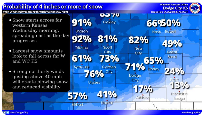
A winter storm watch remains in effect for Ellis County from 6 a.m. Wednesday to 6 a.m. Thursday, the National Weather Service in Dodge City reported.
A winter storm warning in in effect in counties to the northwest.
Snow is expected to arrive in the Hays area after noon, with accumulation expected to be between 1 to 3 inches through the day. Up to 5 additional inches of snow is possible throughout Wednesday night and into Thursday morning.
Up to 10 inches of snow is possible farther northwest, where a winter storm warning is in effect beginning at 11 p.m. Tuesday.
The snow will be accompanied by blustery north-northeast winds, with gusts up to 45 mph. The NWS warned of slippery road conditions and reduced visibility.
After a light rain that brought just 0.05 inches of moisture to the Hays area overnight, there is a 60 percent chance of additional showers between 2 and 5 p.m. Wednesday — although less than a tenth of an inch of rain is expected, the NWS said.
Check Hays Post and tune into your Eagle Radio of Hays stations for the latest on severe weather and cancellations.