
By CRISTINA JANNEY
Hays Post
Ellis County is under a flood watch from late Wednesday through Thursday.
Other counties in the area that are included are Trego, Ellis, Scott, Lane, Ness, Rush, Hamilton, Kearny, Finney, Hodgeman, Pawnee, Stafford, Stanton, Grant, Haskell, Gray, Ford, Edwards, Kiowa, Pratt, Morton, Stevens, Seward, Meade, Clark, Comanche and Barber.
Hays received .15 inches of rain on Tuesday, according to the K-State Ag Research Center. That was in addition to 3.5 inches of rain received during the weekend.
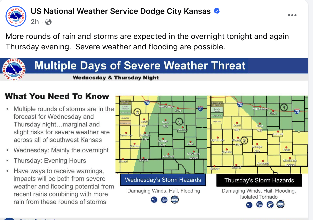
More rain is in the forecast for tonight and Thursday, according to the National Weather Service.
Another thunderstorm complex is expected late tonight through Thursday, with another 1-3 inches of rain probable, according to the Weather Service.
Excessive runoff might result in flooding of rivers, creeks, streams and other low-lying and flood-prone locations.
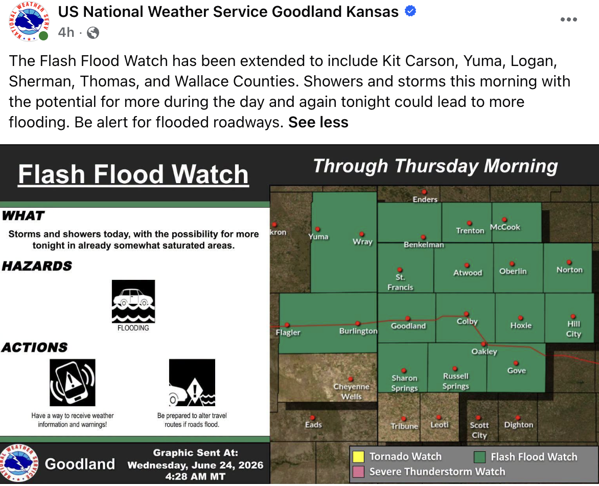
Northwest Kansas is also under a flood watch to include southwest Nebraska and northeastern Colorado.
Area creeks and streams are running high and could flood with more heavy rain.
Skies are set to begin to clear on Friday in Hays with the forecast of partly cloudy skies and a high of 79. The heat returns on Saturday with a forecast of a high of 93.