
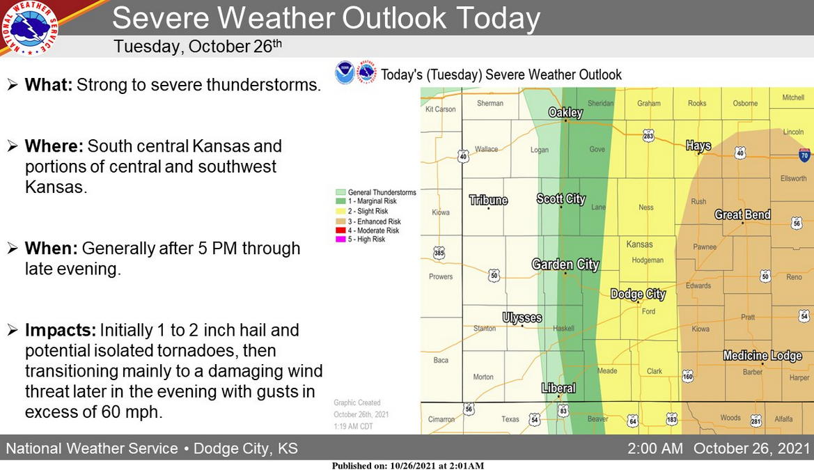
The National Weather Service in Dodge City is predicting severe weather Tuesday evening that could bring high winds, large hail and isolated tornadoes.
Hays and Ellis County is on the western edge of the projected severe weather.
The NWS is forecasting the storms starting around the U.S. 283 corridor and moving east through midnight.
In Hays, there is a 70 percent change of precipitation, with the NWS calling for up to a half-inch of rain and winds 16 to 25 mph through the evening.
The chance of rain persists into Wednesday morning. On Wednesday, winds are expected to be 26 to 31 mph with gusts up to 45 mph. Skies are expected to clear Wednesday and through the weekend, with high temperatures in the high-50s to mid-60s and lows approaching the freezing point.
Check Hays Post or tune into your Eagle Radio of Hays stations for the latest on severe weather.