
UPDATED 4:30 p.m. Wednesday
LATEST CANCELLATIONS AND DELAYS
There is a 90 percent chance of snow after midnight Wednesday, as much of western Kansas remains in a winter weather weather watch and wind chill advisory with Winter Storm Elliott bearing down. There is also a chance of freezing fog after 7 p.m. Wednesday.
Weather is now expected to shift dramatically after 8 p.m. Wednesday.
Less than an inch of snow is expected in Hays and Ellis County. Accumulation is expected to be greater in counties to the north, with 2 inches of snow possible.
There is a 50 percent chance of additional flurries continuing into Thursday evening.
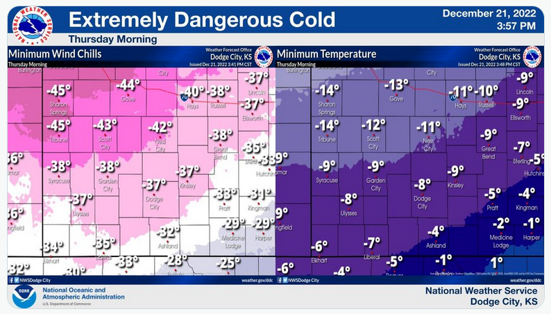
The low temperature overnight is expected to plunge to 11 below zero heading into Thursday, when the high is now expected to be 2 degrees. North winds will blow steady between 27 and 37 mph, with gusts up to 55 mph, the National Weather Service in Dodge City reported.
Wind chills could be as low as 45 below zero, the NWS warned, creating dangerous conditions for people, pets and livestock.
Check Hays Post or tune into your Eagle Radio of Hays stations in the case of severe weather.