After one more hot June day, forecasters are warning of a dramatic shift in the weather starting Tuesday.
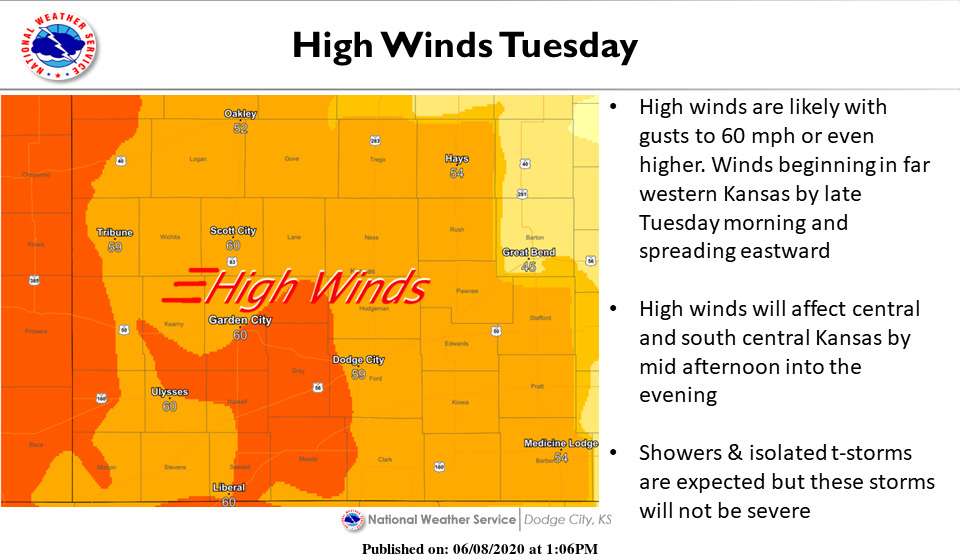
After the mercury reaches the mid- to upper-90s again Monday, the National Weather Service in Dodge City is predicting a cold front will rush through western Kansas starting Tuesday morning.
The high Tuesday is only expected to reach 68 degrees, with strong winds of up to 50 mph out of the northwest.
Isolated thunderstorms and rain showers could accompany the front, forecasters said. As of mid-afternoon Monday, the chance of rain in the Hays area was 40 percent. The overnight low Tuesday will drop to the low-50s.
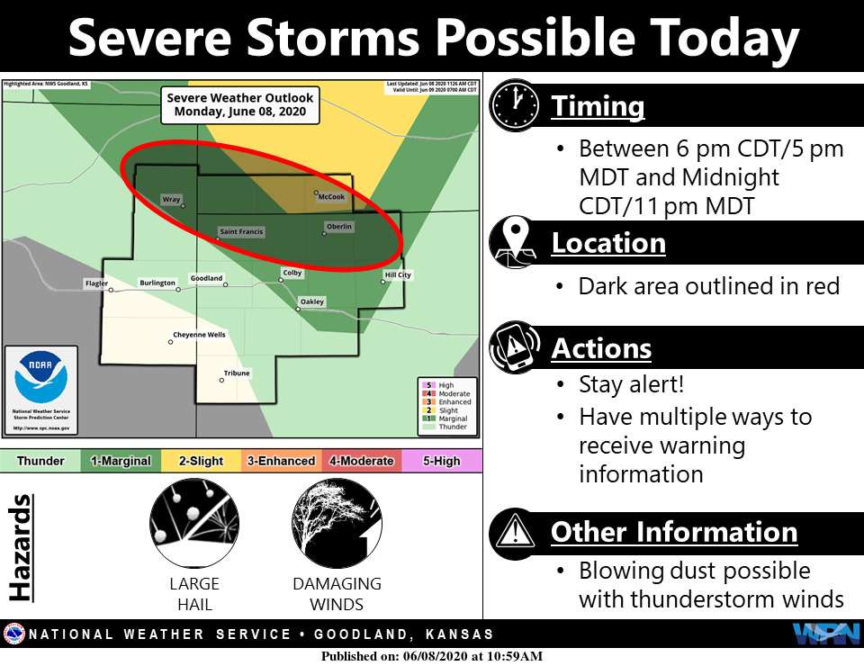
Farther west, the NWS in Goodland is predicting the front and potential storms to reach its coverage area Monday night, with the St. Francis and Oberlin areas now under a severe weather outlook.
Skies will clear Wednesday, and the winds are expected to subside by Thursday, when the temperature again is expected to reach 90.
Check Hays Post and stay tuned to your Eagle Radio of Hays stations for the latest on cancellations and severe weather.