 The National Weather Service in Goodland has issued a hazardous weather advisory for northwest Kansas.
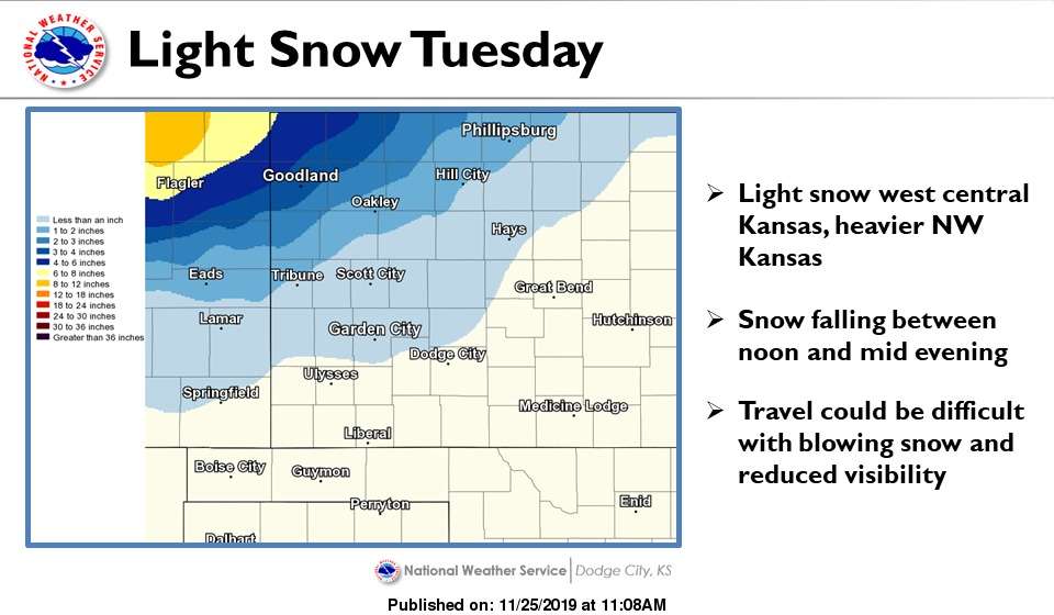
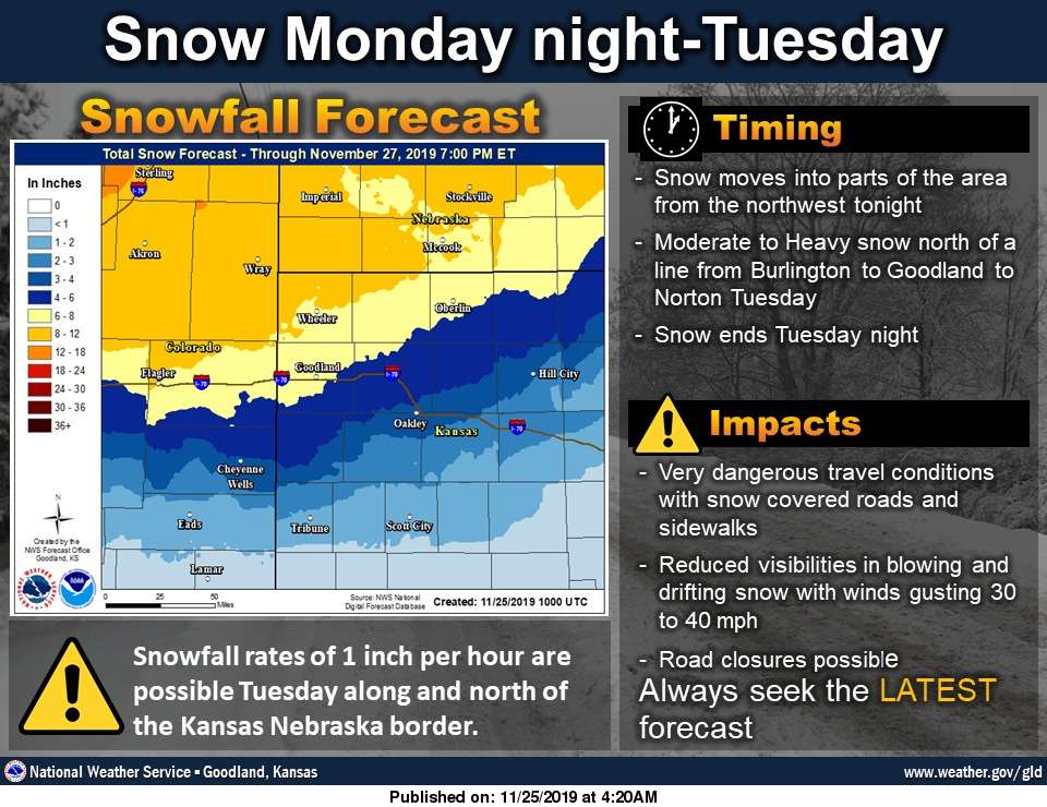
Forecasters are calling for a storm to move into extreme western Kansas at 11 p.m. MST Monday. The event is expected to last through 5 p.m. Tuesday and included Sherman, Thomas, Decatur, Cheyenne, Rawlins and Norton counties
Rain is expected to quickly change to snow as the temperature falls into the low 20s overnight Monday. Accumulation of more than 6 inches is possible north of Interstate 70 and west of U.S. 83. Winds up to 45 mph will make travel precarious.
In Hays and Ellis County, winter weather is expected to arrive late Tuesday afternoon, with drizzle turning to snow after 4 p.m. Winds up to 25 mph are expected, and 1 to 3 inches of snow could be possible.
The skies are expected to clear Wednesday, with a 50 percent chance of snow returning Wednesday night or Thanksgiving Day. Precipitation is expected into the weekend, although the mercury is expected to rise to the low to mid-50s by Friday.
Click HERE for the complete extended forecast and check Hays Post and your Eagle Radio of Hays stations in case of severe weather.