By CRISTINA JANNEY
Hays Post
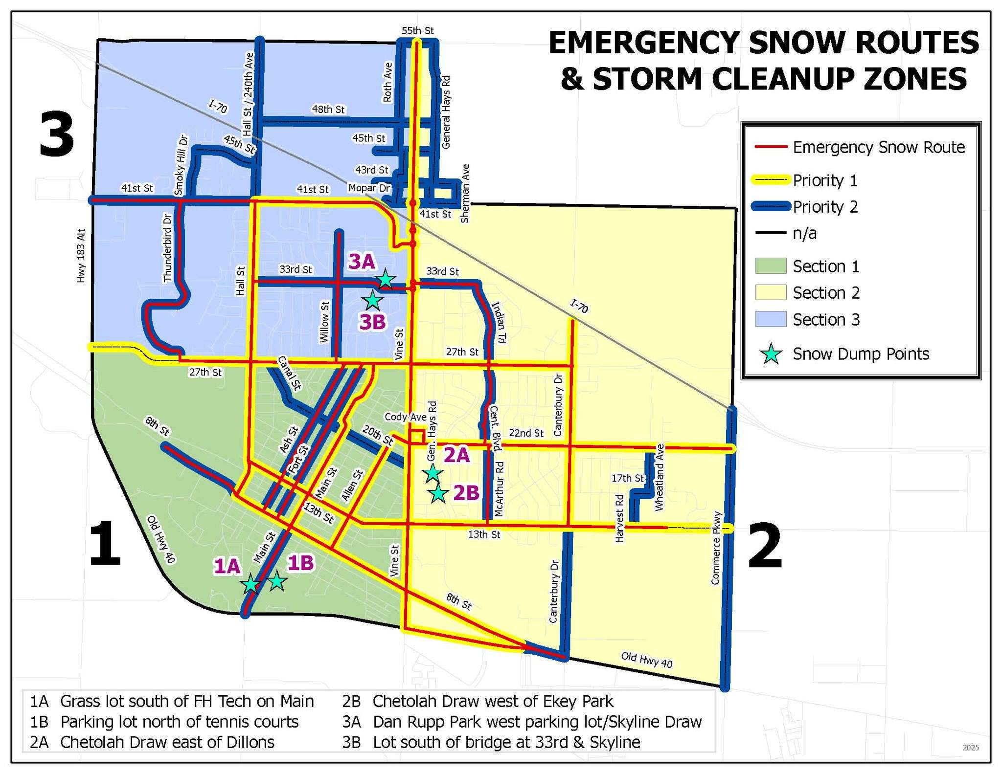
The National Weather Service has issued a hazardous weather outlook for Friday for Hays and Ellis County.
Other affected areas include: Trego, Scott, Lane, Ness, Rush, Hamilton, Kearny, Finney, Hodgeman, Pawnee, Stafford, Stanton, Grant, Haskell, Gray, Ford, Edwards, Kiowa, Pratt, Morton, Stevens, Seward, Meade, Clark, Comanche and Barber counties.
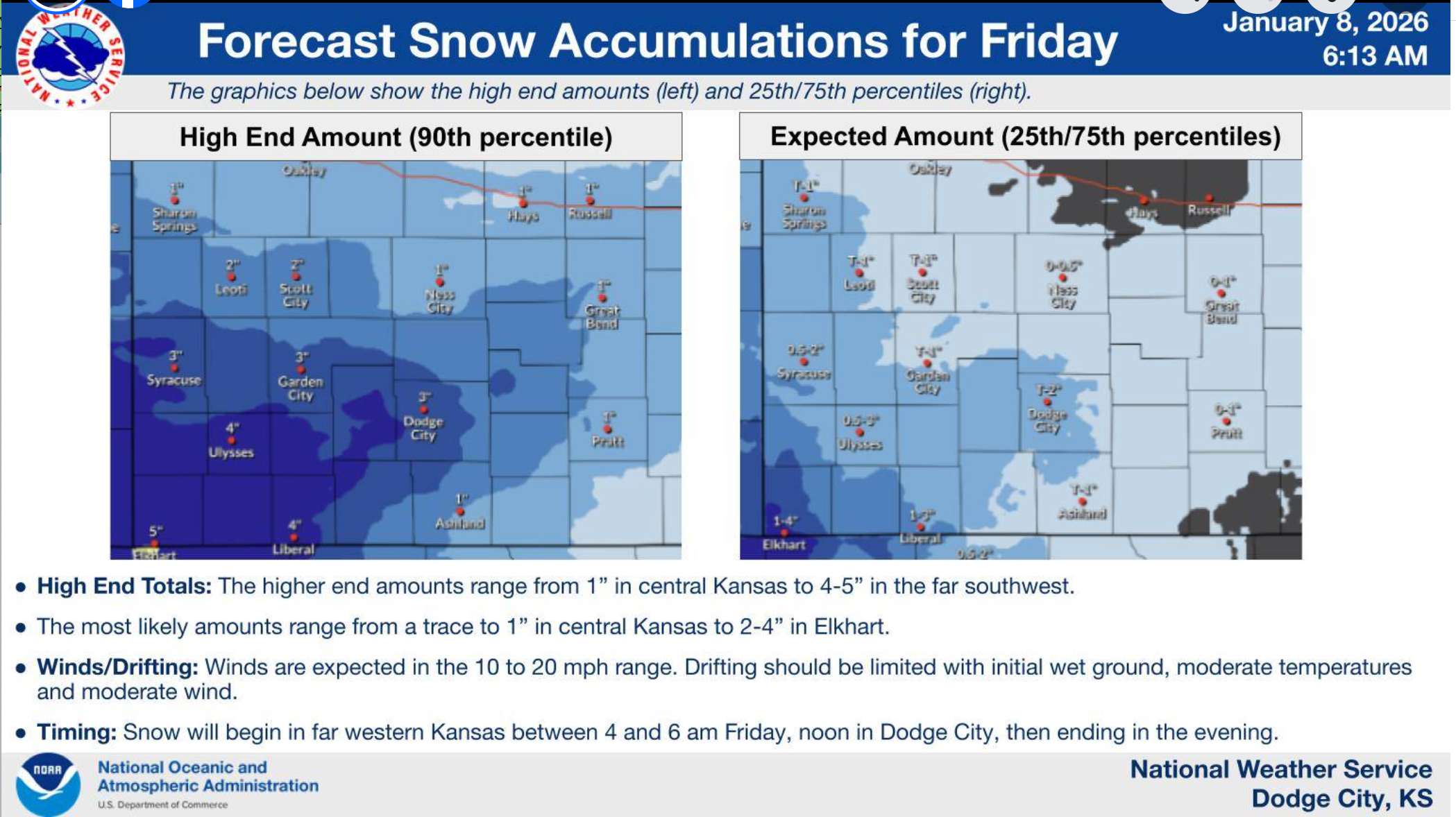
Light snow will develop near the Colorado border after midnight, according to the National Weather Service.
This light snow will continue west of U.S. Highway 83 through daybreak and then begin to spread east across the remainder of southwest Kansas on Friday.
The overnight snowfall is expected to end by 6 a.m. Friday and is currently expected to be light and average less than one inch.
Snowfall is expected to continue to accumulate on Friday, with totals between 0.5 to 1.5 inches likely, but there is a 60-80% chance that over 2 inches will be possible before the snow ends west of a Liberal to Sublette line.
Saturday and Sunday are forecast to be sunny with highs in the mid-40s.
The highs in Hays Monday through Wednesday are forecast in the 50s.