
The National Weather Service in Dodge City has revised its forecast as a cold air mass makes its way to the central United States later this week.
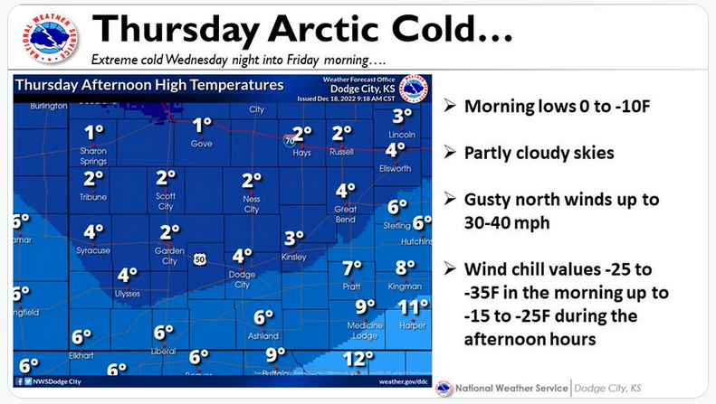
The high temperature in the Hays area by Thursday is now expected to be as low as 3 below zero, with an overnight low Thursday of 12 below zero possible.
On Monday, the high is expected to be the low-40s, dropping the to mid-20s on Tuesday and Wednesday.
Wednesday also brings a 40 percent chance of snow, increasing to 70 percent through the night and into Thursday morning. The greatest threat of snow is on the Interstate 70 corridor between Hays and WaKeeney.
In addition to the bitterly cold conditions, the wind is also expected to pick up Thursday, gusting to up to 50 mph and leading to dangerously cold wind chills — as low as 35 degrees below zero.
Check Hays Post or tune into your Eagle Radio of Hays stations in the case of severe weather.