
By MIKE COURSON
Great Bend Post
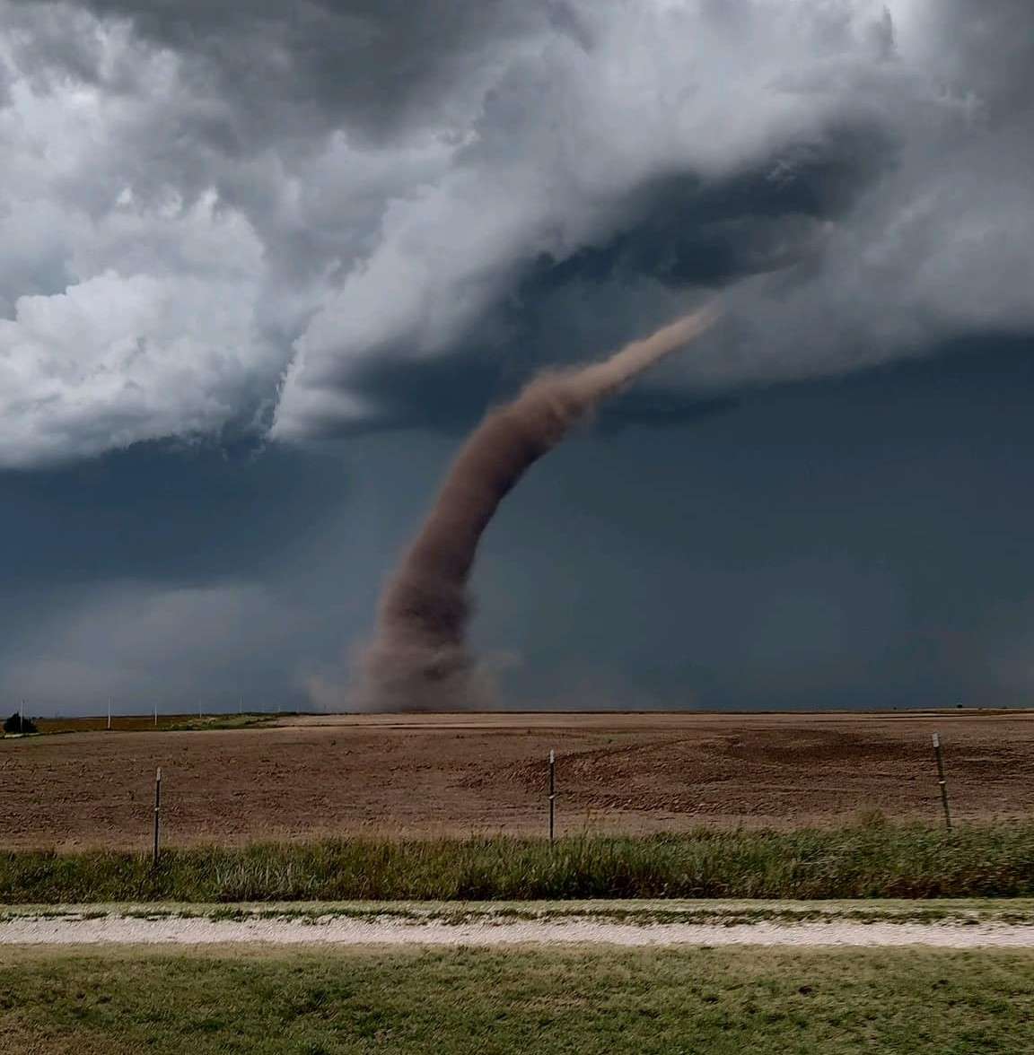
The arrival of fall does not mean the end of the severe weather season. Severe thunderstorm warnings were issued Tuesday evening in portions of Rush and Pawnee counties. Photos of a funnel on the ground near Alexander between Rush Center and Ness City generated lots of debate: was it a landspout or a tornado? Chance Hayes, Warning Coordination Meteorologist with the National Weather Service in Wichita, said it was a landspout and explained the difference.
"They are similar in that they're both rotating columns of air in contact with the ground," he said. "The difference between a true tornado and what we consider a landspout is the type of storm it comes from."
Tornadoes come from supercell thunderstorms that contain a rotating updraft. That updraft, Hayes said, is merely air rising into the atmosphere and spinning as it does. Landspouts typically occur at the beginning of a storm when the white and puffy cumulus clouds begin to rise and pull any circulation along the ground up with them.
Hayes said that's likely what was photographed Tuesday in Rush County, and because landspouts are not powerful, tornado warnings are typically not issued.
"Because there is such a low threat to structures, and an even lower threat to lives, we don't feel like all the bells and whistles need to be sounded because it's so much weaker than a typical tornado that we will issue a special weather statement," Hayes said.
Hayes said landspouts may cause damage to trampolines that are not anchored or to old structures like barns or sheds. Should a landspout move into a heavily populated area that may experience more damage or flying debris, the National Weather Service may choose to issue a stronger warning.