
By JULIE TOLLESON
KU News Service
LAWRENCE—The Kansas Geological Survey has released a new full-color geologic map of Jewell County, where an ancient inland sea left rocks rich in fossils, time and erosion created a striking landscape, and excavations reveal evidence of prehistoric people.
Authors of the map are William C. Johnson, professor emeritus, Department of Geography & Atmospheric Science, and Terri Lee Woodburn, director of the Environmental Assessment Professional Science master’s program and associate teaching professor, University of Kansas. KGS cartographers John Dunham and Emily Bunse contributed map layout and database design.
Jewell County lies in the Smoky Hills physiographic region of the state along the Nebraska border. The new map shows the type and age of rock layers found at or near the surface in the north-central Kansas county and identifies deposits of rocks and other materials of economic importance for construction and roads.
The county’s surface and near surface sedimentary bedrock formed during the Cretaceous geologic period 100 to 80 million years ago when the Western Interior Seaway covered the present-day Great Plains.
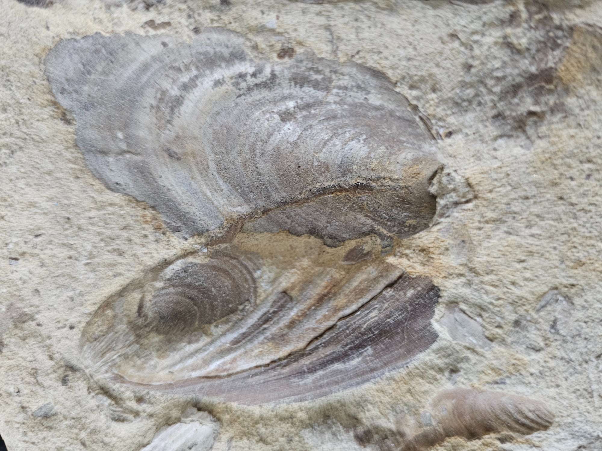
The rocks found in the county today are rich in marine fossils, including Inoceramus and Ostrea shells, turtles, rays and mosasaurs. A sandstone within the Dakota Formation known as the “shark-tooth conglomerate” contains teeth from several species of shark. In 1874, Benjamin Mudge, the first director of the Kansas Geological Survey, discovered a plesiosaur — a large, swimming reptile — in the Fort Hays Limestone Member in Jewell County.
Excavations at Lovewell Reservoir uncovered the bones of several mammoths associated with the Last Glacial Maximum, the last time glaciers reached their maximum extent, 20,000-26,000 years ago during the Pleistocene. A collection of other Pleistocene fossils discovered in the area, called the Lovewell Local Fauna, include camels, dire wolves, horses, llamas, sloths, and small mammals, toads, snakes, fish and birds.
“Archaeological excavations have indicated that prehistoric peoples occupied Jewell County, with the most extensive cultural activity apparently adjacent to Lovewell Reservoir and the rest of White Rock Creek valley,” Johnson said.
Unique geology
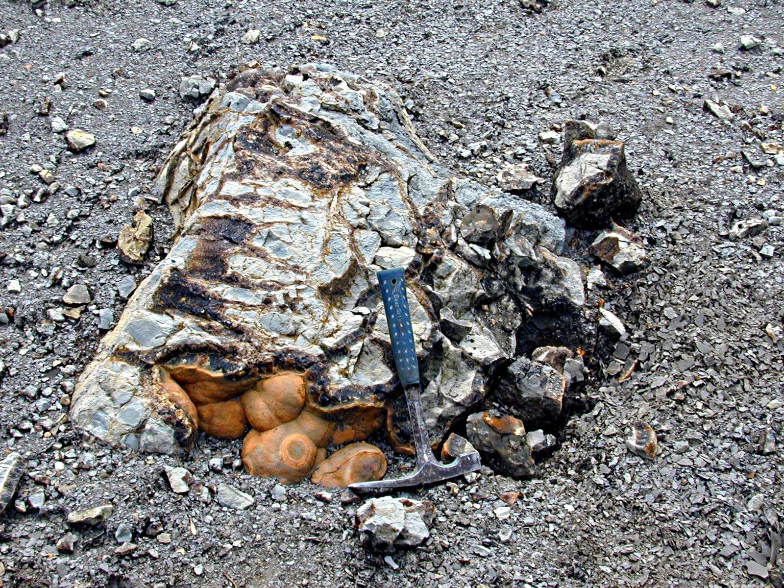
“The most prominent geological feature in Jewell County is the Niobrara Escarpment, which becomes apparent as you travel northwest from the plains in the southeastern part of the county toward the town of Mankato,” Woodburn said. “Erosion beneath the Fort Hays Limestone Member of the Niobrara Chalk reveals the distinctive Blue Hill Shale Member of the Carlile Shale, with its bluish-black coloring. This exposure creates a striking and unexpected landscape.”
Where the Blue Hill Shale Member is visible, large septarian nodules often can be found. These unusual rocks are concretions composed of brown calcite and cemented sediment.
The Jewell County map identifies sources of rocks and other materials used in construction and road development.
“Historically, the geologic resources of Jewell County have included sand and gravel, limestone, the post-rock building stone, chalk, ceramic clays, volcanic ash and lignite (a type of coal),” Johnson said. In the late 1800s and first half of the 1900s, residents mined lignite from the Dakota Formation for heating and cooking, fence-post limestone from the top of the Greenhorn Limestone for fencing and building construction, and volcanic ash for use in abrasives, ceramics, concrete and paint, among others.
Today, the main resources found in Jewell County are limestone from the Fort Hays Limestone Member, exposed along the Niobrara Escarpment, and the Greenhorn Limestone; sand and gravel from river deposits; and sandstone and shale from the Dakota Formation along Buffalo Creek.
About the map
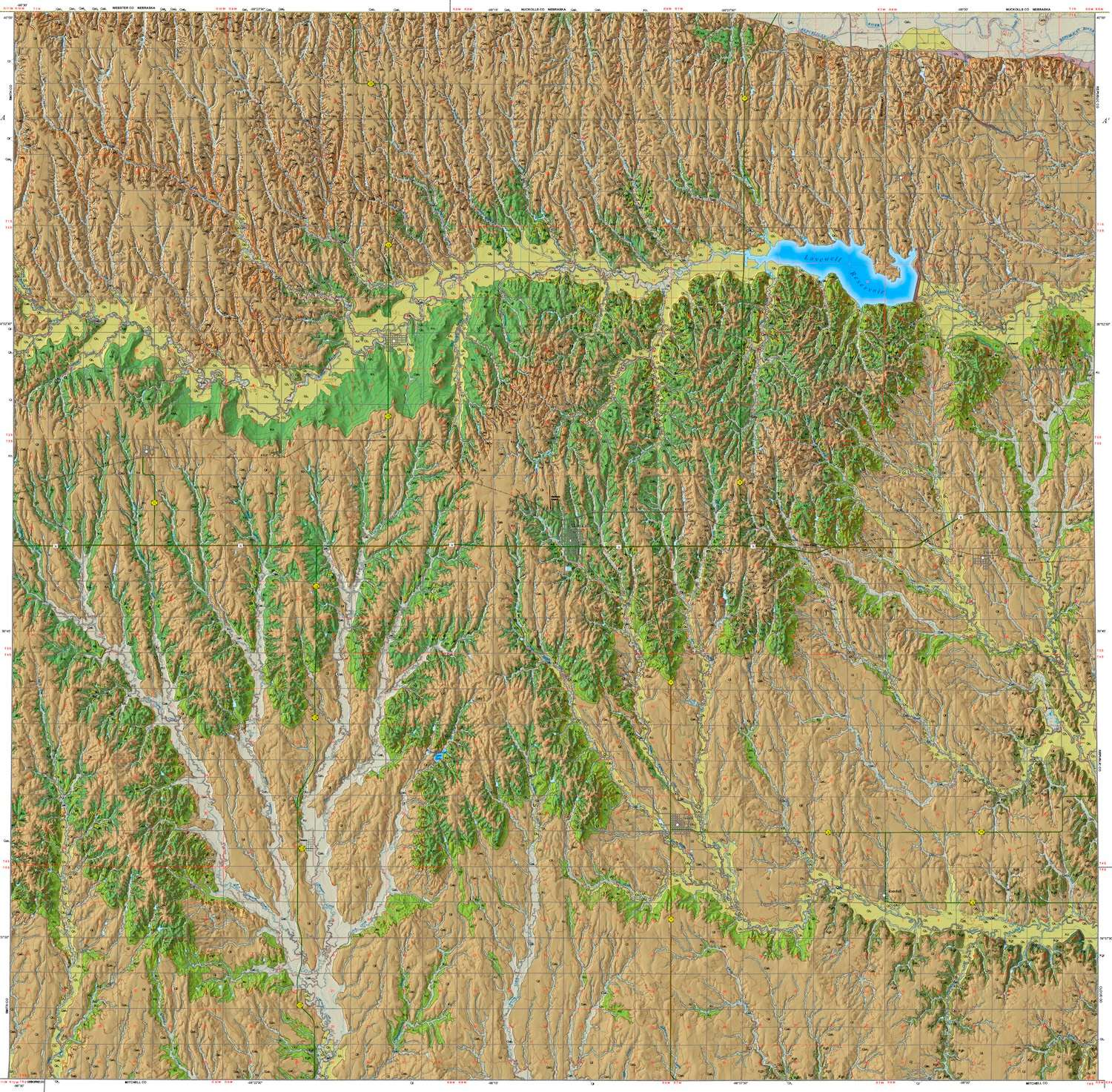
The 62-inch by 49.5-inch “Surficial Geology of Jewell County, Kansas” contains the map; a report on the geography, geology, water and mineral resources, and paleontology of the county; a cross section; and an illustrated stratigraphic column. Shaded relief provides a three-dimensional quality that accentuates the hills and valleys. The cross section depicts a vertical slice of subsurface rock layers along a line running west to east across the county. The stratigraphic column shows the order in which rock units were deposited over time and a description of each unit.
Towns, roads (from highways to unimproved roadways), elevation contours at 25-foot intervals, and township and range boundaries also appear on the map.
The scale is 1:50,000, so that one inch on the map equals about three-quarters of a mile of actual distance. The map can be accessed online.
Geographic information systems (GIS) data for the map will be available for download from the Kansas Data Access and Support Center (DASC), housed at the KGS, and the U.S. Geological Survey National Geologic Map Database catalog. GIS data helps geologists visualize, analyze and interpret the geology of a mapped area.
Paper copies of “Surficial Geology of Jewell County, Kansas” may be purchased by contacting the KGS publication sales office at 1930 Constant Ave., Lawrence, KS 66047-3724 (phone 785-864-3965 or email kgs-publications@ku.edu) or the KGS’s Kansas Geologic Sample Repository at 4150 W. Monroe St., Wichita, KS 67209-2640 (phone 316-943-2343 ext. 200 or email kgsr@ku.edu). The cost is $20 plus shipping and handling and, for Kansas residents, sales tax.
More information about county geologic maps and other KGS products is available on the KGS website.