
FRANKLIN COUNTY —On Monday evening, scattered severe storms developed across portions of east central Kansas. Very large hail up to baseball size, 2.75 inches, were reported from Lyon, Osage, and Franklin counties.
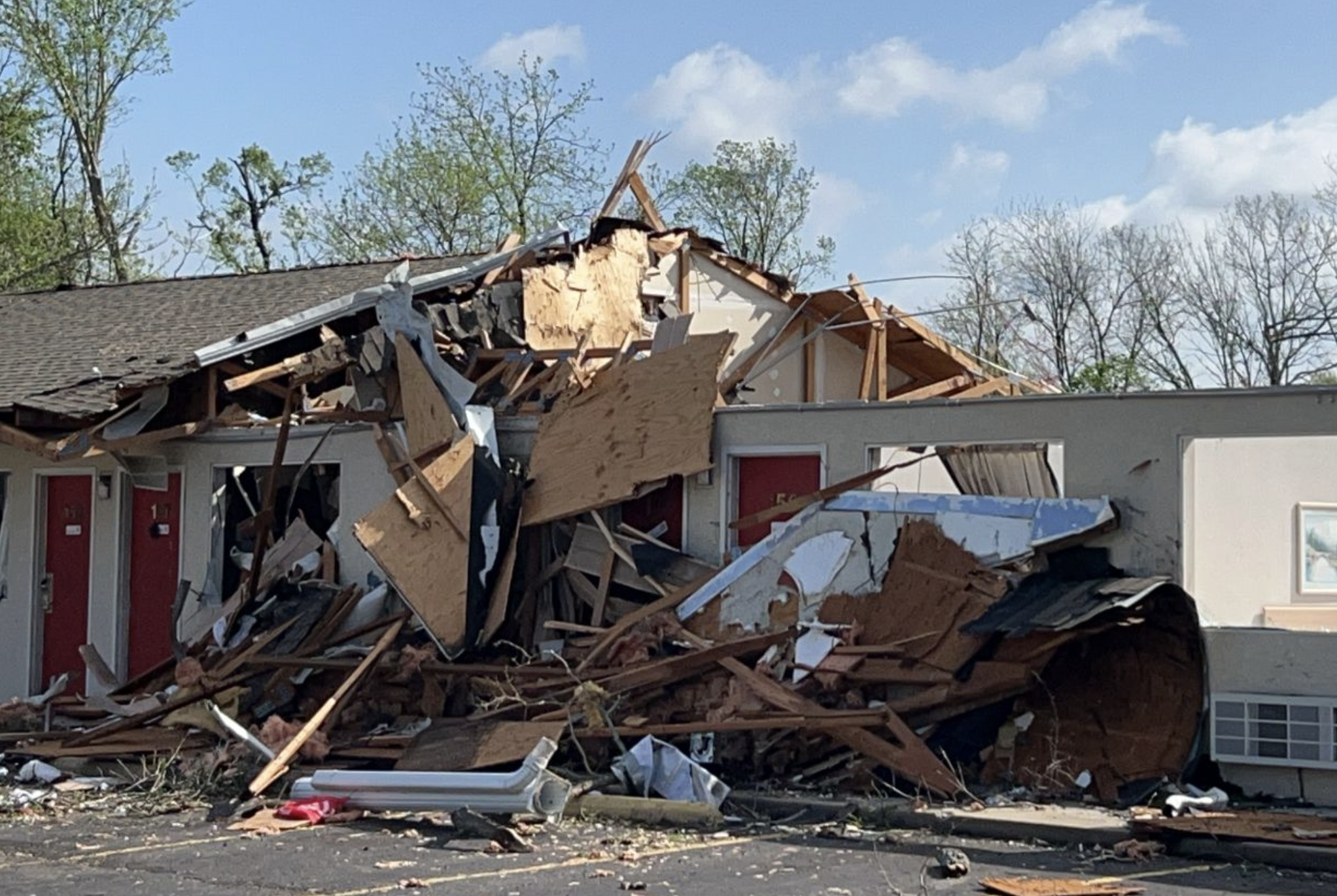
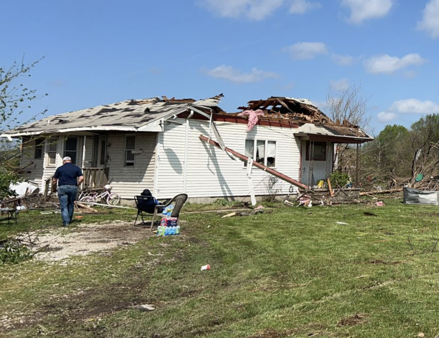
Additionally, two tornadoes were confirmed, one of which produced a wide swath of EF-2 damage across Ottawa in Franklin county.
The first tornado quickly developed a few miles west of Ottawa at 7:23p.m. before entering the southern side of the city. The tornado had peak winds of 125mph,with a maximum width of 100 yards and was on the ground for 7.3 miles, according to the National Weather Service in Topeka.
Much of the damage occurred to businesses and homes in Ottawa and locations just east of the town.
In Osage County, a brief tornado occurred near the rural community of Quenemo and was confirmed by multiple reports and video from trained spotters. It had an EF0 with peak winds of 65, a maximum width of 100 yards and was on the ground from 7:02-7:03p.m.
There were no serious injuries reported from these storms.
The National Weather Service has not released details on the storm that struck Miami County.